


Talk to an Expert

|
Dale Hylton - Sales Engineer 844-474-8833 x2 |
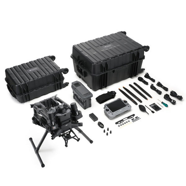
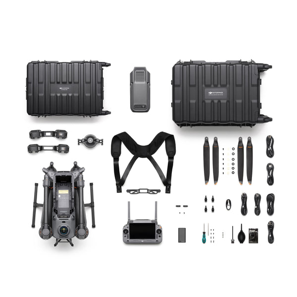
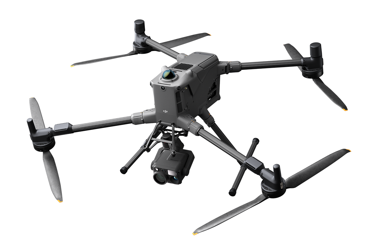
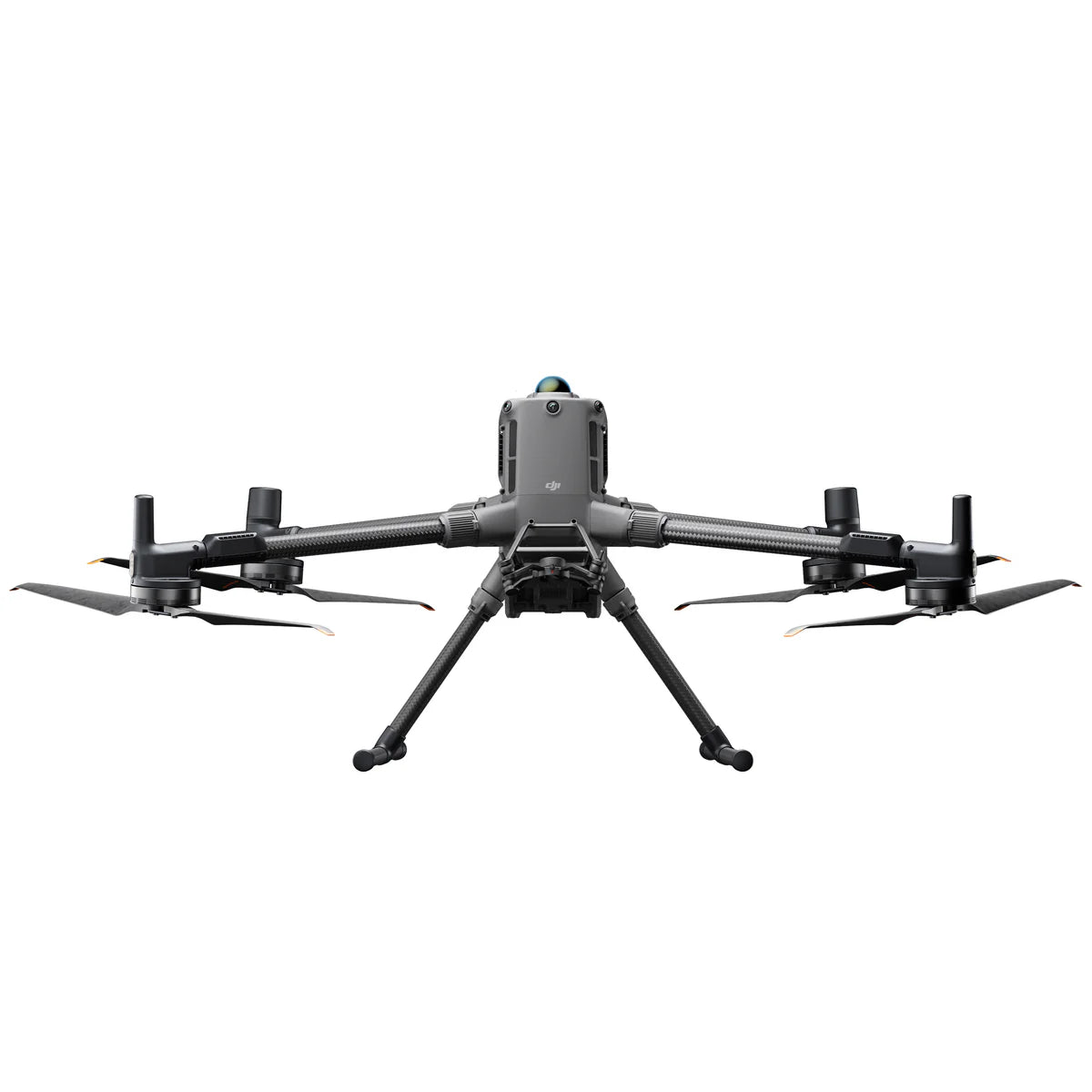
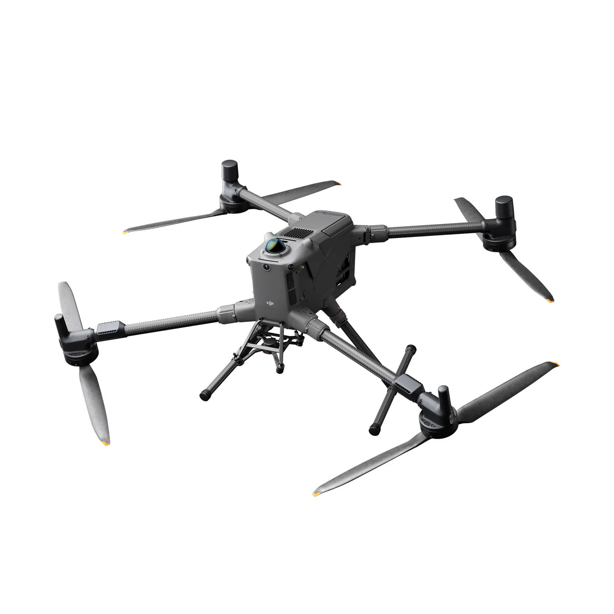
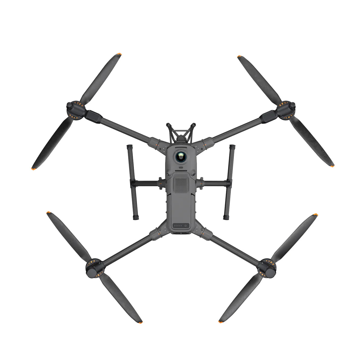
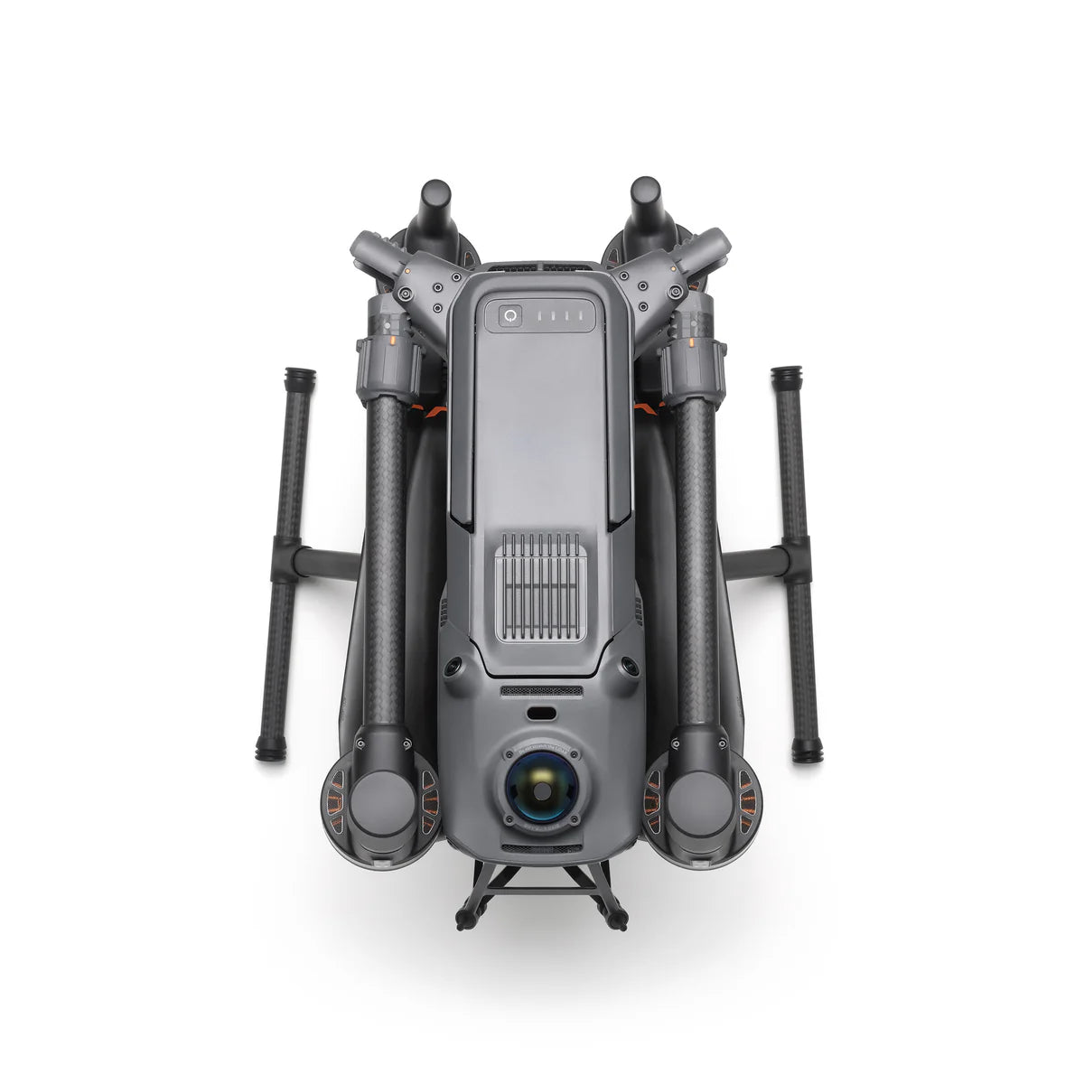
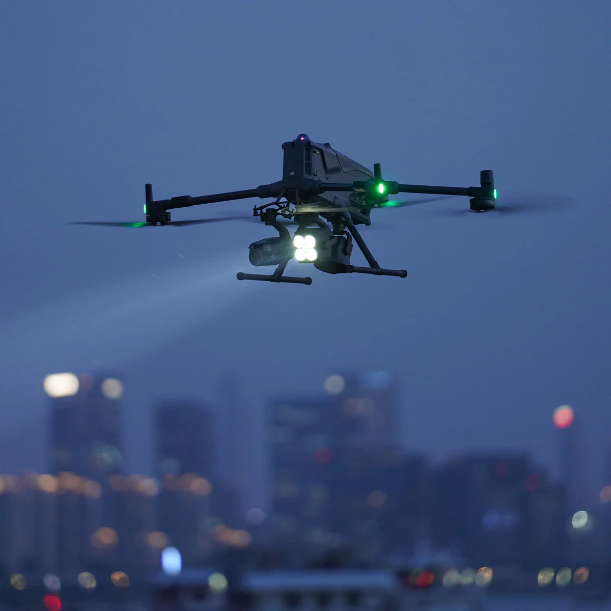
DJI Matrice 400 — engineered for excellence, designed for unmatched versatility. DJI’s newest enterprise flagship stretches flight endurance, payload flexibility, and situational awareness further than any Matrice to date. With a class-leading 59-minute forward-flight time, a 13.2 lb / 6 kg maximum payload, and a triple-layer obstacle-sensing suite that pairs rotating LiDAR with mmWave radar and full-color low-light vision, the M400 empowers power-grid engineers, search-and-rescue crews, surveyors, and AEC professionals to cover more ground in fewer flights—day or night, rain or shine.
Extended Flight Time & High-Speed Performance
- Fly Longer — 59 min forward flight / 53 min hover* keeps wildfire overwatch, wide-area SAR, and long-corridor mapping missions on a single battery set.
- Arrive faster — 25 m/s (≈ 56 mph) max cruise slashes transit legs while the obstacle-sensing array actively scans for buildings, towers, and terrain.
- TB100 Intelligent Flight Batteries deliver up to 400 charge cycles, self-heat below 50 °F (10 °C), and recharge to 100 % in just 45 min** inside the BS100 station.
Multi-Payload, Multi-Scene Versatility

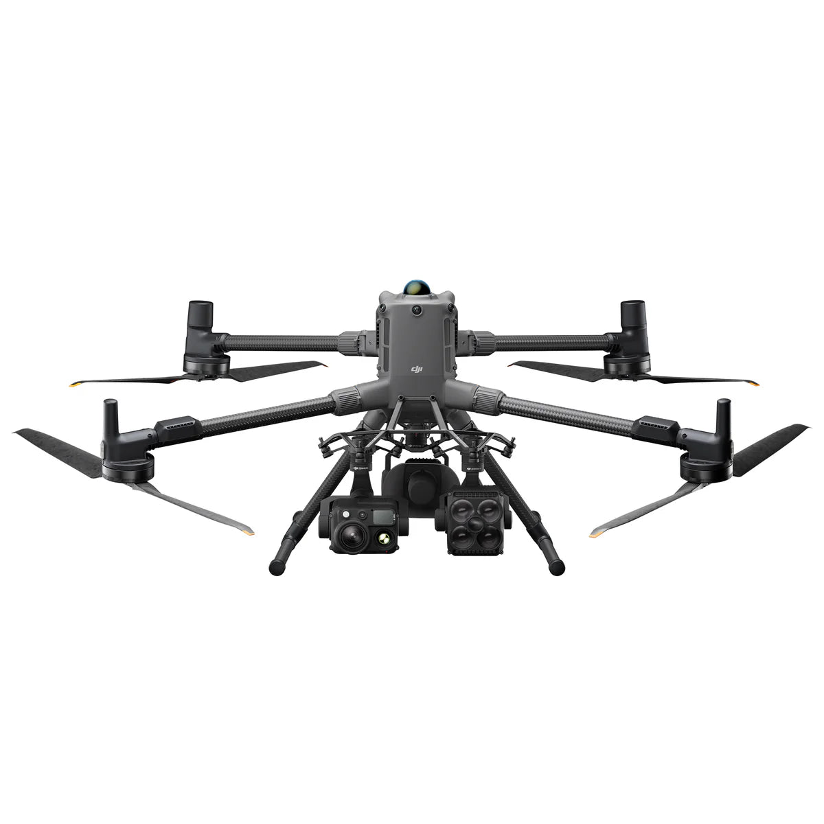
DJI Matrice 400 - 6kg (13lbs) Payload Capacity
Four E-Port V2 interfaces, dual downward gimbals, and a third underslung gimbal connector let the M400 fly up to seven simultaneous payloads. Seamlessly switch between single - or dual-gimbal set-ups to suit the assignment.
Compatible Payloads:
- Zenmuse H30 Series — 5-in-1 sensor block (wide, zoom, thermal, LRF, NIR) shattering day-to-night ISR limits.
- Zenmuse L2 LiDAR — 240 k pts/s frame-based LiDAR + 4/3 ″ RGB for centimeter-grade point clouds.
- Zenmuse P1 Photogrammetry — full-frame, 45-MP stills at 0.7 s intervals with 24 / 35 / 50 mm lenses.
- Zenmuse S1 Spotlight & Zenmuse V1 Speaker — 32 W LEP long-throw lighting and 114 dB PA for night SAR, crowd comms, and tactical ops.
- Manifold 3 — 100 TOPS NVIDIA® processing unlocks onboard AI models and advanced autonomy.
*Payloads sold separately.
Flight Time
Estimate the Matrice 400’s flight time based on your payload configuration.

Safe and Reliable Flight
Built for Challenging Conditions
Rated IP55, the Matrice 400 performs dependably in harsh environments, shrugging off heavy dust and rain. Designed for temperature extremes, it delivers consistent performance from –20 °C to 50 °C (–4 °F to 122 °F), ensuring reliable results in both frigid and scorching conditions.
Power-Line-Level Obstacle Sensing
An integrated rotating LiDAR + mmWave radar + full-color low-light vision system detects obstacles as small as 0.85 in / 21.6 mm conductors at speeds up to 56 mph—even in fog, rain, or total darkness. Six fisheye cameras switch to black-and-white below 12 lux for enhanced contrast, while GNSS + Vision Fusion maintains precise positioning in GPS-denied canyons, under bridges, and alongside glass-curtain facades.
Robust Video Transmission & Airborne Relay
- O4 Enterprise Enhanced streams 1080p / 60 fps up to 24.9 mi / 40 km (FCC) line-of-sight.
- Sub-2 GHz fallback & dual 4G DJI Cellular Dongle 2 keep the downlink alive in RF-dense metros and remote valleys.
- Airborne Relay mode turns a high-hover M400 into a skyborne repeater, extending C2 links for a second drone beyond ridgelines or deep inside urban canyons.
Aircraft Fusion Positioning & Full-Color Vision Assist
Rotating LiDAR, radar, and fisheye vision fuse with dual-band GNSS to create centimeter-class positional accuracy—even when primary satellites fade. Four full-color fisheye sensors feed Full-Color Vision Assist, overlaying a pilot-eye view on the controller to reveal blind-spot hazards during complex maneuvers.
Enhanced Intelligence & Operational Efficiency
Smart Detection
Paired with the H30 Series, onboard AI auto-labels vehicles, vessels, and people across visible and thermal feeds, pushing real-time metadata to FlightHub 2 for team-wide situational awareness.
Smart AR Projection
- Power-Line AR highlights conductors as bold on-screen vectors, slashing pilot workload in lattice corridors.
- Map View AR labels buildings, landmarks, and core roadways in real time—day or night.
- AR Waypoint & Landing Shadow previews RTH routes and projects an on-ground aircraft shadow to nail pinpoint touchdowns.
Real-Time Terrain Follow
Maintains constant AGL in any horizontal direction—perfect for slope mapping, forest SAR, or uniform-GSD photogrammetry.
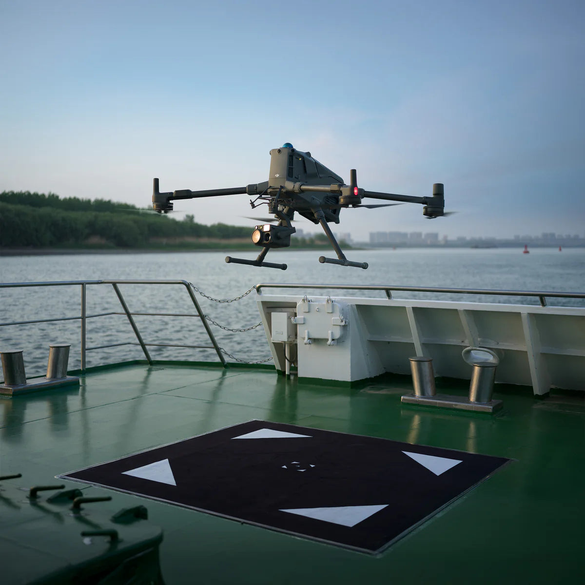
Takeoff & Landing on Ships
Pattern-recognition landing detects deck markers and lands safely on vessels moving ≤ 10 knots (11.5 mph). Critical for coastal patrol and offshore turbine inspection.
Intelligent Flight Modes
- Cruise — lock heading and speed for mile-long linear surveys without thumb fatigue.
- FlyTo — single-tap rerouting with obstacle-aware path planning to the clicked waypoint.
- Smart Track — auto-zoom, subject re-acquisition, and hands-off orbiting for persistent target coverage.
- POI — automated 360° orbits and 3D modeling of assets such as stacks, spires, or cell towers.
Easier Automated Operations
The M400 natively supports DJI Pilot 2 quick-task templates, slope and geometric route planners in FlightHub 2, and power-line follow missions when paired with the Zenmuse L2 LiDAR. Onboard compute continuously analyzes LiDAR returns to auto-sidestep crossing conductors during energized-line patrols.
Our on-line store is open 24/7 and we ship Monday through Thursday, excluding some holidays. Orders received for products without shipping restrictions on its product page will ship the same business day when received before 12:00 p.m. PST. Orders in high demand will have an estimated time listed on its product page and will ship according to the date listed.
Signature is required for most shipments.
*How long does it take for you to ship a product?*
This depends on your location, the method of shipping and the item you choose.
For in stock items inside the USA we typically ship by UPS and FedEx and for small items we ship by USPS. We typically ship items within 1-2 business days of the order for in stock shipment.
Ground Shipments can take up to 5 Business days from our Washington location. Express options are available by contacting us, but UPS and FedEx do NOT guarantee any shipments at this time.
If there are lithium batteries (most drones & ROVS), these cannot be shipped express.
USPS typically takes 2-3 business days for the smaller items by priority mail.
Special Order items can take time to arrive, but once they arrive we ship them out right away.
SHIPPING NOTES:
- Orders under $50 = $25 Ground Shipping & Handling
- Orders $50-499.99 = $20 Ground Shipping & Handling
- Orders $500 or higher = FREE Ground Shipping & Handling (USA Only)
- Alaska & Hawaii have unique shipping starting at $75
- Contact us for Express Shipping Options
- DHL & UPS Available for International Orders*
*International shipments are typically sent by DHL or UPS. Please note you are responsible for any customs fee, taxes and brokerage fees that may be due by importing an item into your country.

At Blue Skies Drones, your safety and confidence while flying are always a top priority. That’s why we’ve partnered with SkyWatch—a trusted name in drone insurance—to help ensure you’re protected every time you take to the skies.
Whether you're flying recreationally or professionally, SkyWatch offers flexible and affordable coverage options tailored to your needs. Choose from hourly, monthly, or annual plans, so you can fly with peace of mind—on your terms.
👉 Coverage available exclusively for customers in the USA and Canada.
![]()
Why Drone Insurance Matters – And Where to Get It
Flying a drone can be exciting and rewarding—but it also comes with risks. While drone insurance isn't always legally required, it’s highly recommended to protect yourself, your equipment, and others around you. Whether you’re flying for fun, professional photography, or commercial inspections, having the right insurance offers peace of mind and may be required by clients or job sites.
💡 Why You Should Consider Drone Insurance
🔹 Liability Coverage
Protects you financially if your drone causes property damage or injury to others.
🔹 Damage Protection
Covers repair or replacement costs if your drone is damaged due to crashes, hard landings, or environmental hazards.
🔹 Theft Coverage
Helps recover losses if your drone or gear is stolen.
🔹 Client & Regulatory Compliance
Many commercial projects, job sites, and government contracts require proof of insurance before allowing flight operations.
🔹 Peace of Mind
Know you’re covered—legally and financially—so you can focus on flying with confidence.
🛡️ Types of Drone Insurance
✅ Liability Insurance – Covers third-party injury and property damage.
✅ Hull Insurance – Protects your drone and payload (like cameras or sensors) from physical damage.
✅ Personal Injury Insurance – Covers medical costs for you or your crew during drone operations.
✅ Commercial Drone Insurance – Designed for businesses with multiple drones/operators, offering bundled and comprehensive policies.
📍 Where to Get Drone Insurance
-
Specialized Drone Insurers (like SkyWatch.AI)
-
General Insurance Providers with UAV policy options
-
Aviation Insurance Firms with experience in drone operations
⚖️ Is Drone Insurance Legally Required?
In the United States, the FAA does not require insurance, but many local governments, private clients, and commercial contracts do. It’s especially crucial if you’re flying professionally or in public spaces.
✔️ Before You Fly
Check with your current insurance provider to see if they cover drone rentals or flight operations. If not, we highly recommend securing coverage before you launch.
We’ve found that SkyWatch.AI offers affordable, flexible, and user-friendly options for drone operators of all levels.
Frequently Asked Questions
Do we offer Financing? The short answer is YES we do!
To determine the best financing option, we need to determine if you are interested in a personal financing option or if you will be using a business to finance your purchase.
 BUSINESS OPTIONS:
We work with 2 different companies for financing. Each Organization has their own criteria for purchases. These Financing options are for US customers only.
-
BNC Financial
Specializes in equipment funding from $500 and up. Follow this link to to the the financing application. -
First Pacific Funding
Financing options from $5000 and up. Follow this link to go to the financing application. - APPROVE Commercial Financing. Add an item to your cart, then click on the APPROVE logo for an inline application on the right hand of your screen. Monthly Payments and rates vary depending on final terms.
https://financing.approvepayments.com/blue-skies-drone-shop
 PERSONAL OPTIONS:
- Affirm
Buy now, pay later without the fees. Affirm is the smartest way to pay over time. Shop pretty much anywhere and pay at your own pace without any fees, so you can get the things you love without breaking your budget.
Affirm is built into our website. Click on the product you are interested in purchasing, then click on the 'Pre-qualify now' link.
Click Here to see the details on how it works -
Shop Pay
This payment option works similar to Affirm. If you do not see the shop pay option on the product page, click on "More payment options.
The Look for the button.